Every square meter.
Every variable.
Every pass.
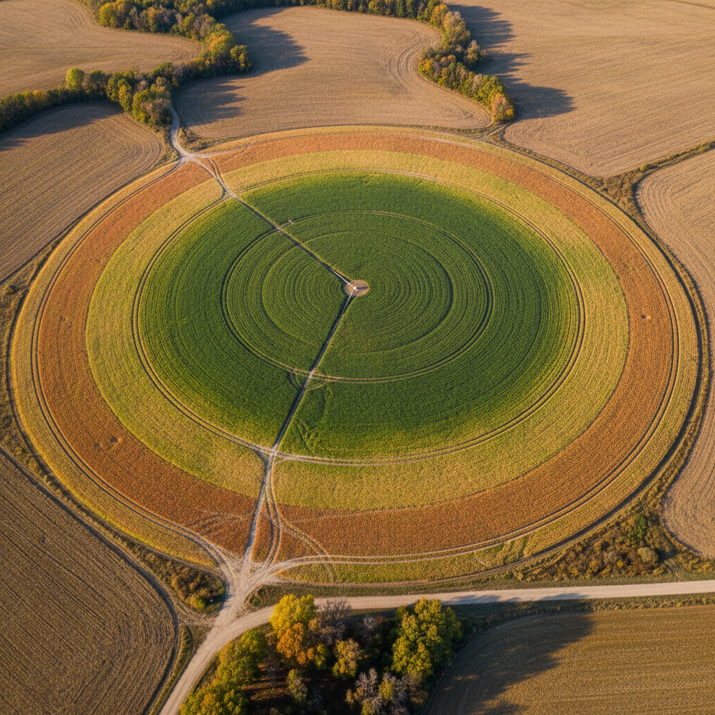
Soil EC, canopy temperature, and moisture gradients turned into prescription maps — delivered to every nozzle and seed tube before the next row.
The field as a
living blueprint
Three sensor layers. One prescription surface. Slide between data transparencies like pulling overlays from a light table.
Sub-meter soil conductivity mapped from 0–12 inch depth. High-EC zones hold water longer — seed populations calibrate automatically.
1 of 3 layers →
Works with the iron
already in your shed
Yield exports ISO-XML prescription files compatible with every major VR controller. No proprietary hardware required.
John Deere
Planter / SprayerExactEmerge, CC1200
Raven
VR ControllerViper 4+, Hawkeye
Trimble
Guidance / DisplayGFX-750, TMX-2050
Case IH
PlanterAFS Pro 700, Precision Planting
Ag Leader
Display / SectionInCommand 1200, Integra
AGCO
Sprayer / PlanterFendt, Challenger VR
CNH Industrial
GuidanceAFS Connect, PLM Intel.
Topcon
PositioningX35, CL-55, AES-25
Don't see your controller? We add new integrations weekly.
Check my hardwareMacro to micro.
Bushels in the bin.
From satellite view to single-row sensor data. Every spatial scale tightens until the precision shows up at settlement.
Corn Yield — Saunders Co., NE
Split-planter trial, 3,100 acres. Precision seeding zones derived from EC map. Year 1 results.
N Fertilizer Cost — Champaign Co., IL
Variable-rate N prescription reduced over-application in high-EC zones. 2,800 acres, 2024 season.
Soybean Stand Uniformity — Boone Co., IA
Moisture gradient map identified delayed-emergence zones. Seeding rate and depth adjusted per row.
“I run 22 grower accounts. Yield collapsed my morning dashboard from 4 screens to one. The prescription is ready before I finish my first cup of coffee.”
“Our co-op needed hard numbers at settlement. Yield gave us a per-field ROI report that made the conversation simple — the data stood on its own.”
Price my operation
Three questions. One transparent per-acre number. No tiers, no hidden fees, no sales call required.
Total managed acres
Include all fields under active management, not just owned ground.
See a sample prescription map for your county
Enter a zip code — we'll generate a demo overlay using real soil survey data